Subscribe

RSS Feed (xml)

Powered By

Skin Design:
Free Blogger Skins

Powered by Blogger

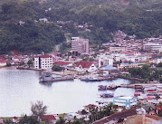
International Biodiversity Conference in Jayapura, Papua - Indonesia, 11-14 November 2009, The First International Conference in Jayapura, Papua - Indonesia with theme " Working together for sustainable development in Tanah Papua for our future " sub theme “Protect Biodiversity, Protect our Life”. Ayo Kita Sukseskan Acara Konferensi Bertaraf International Tentang Keragaman Hayati Papua di Jayapura, Papua. Tema Acara " Bekerja bersama-sama bagi pembangunan berkelanjutan di Tanah Papua demi masa depan kita " Acara ini terlaksana atas kerjasama Pemda Provinsi Papua, Pemda Provinsi Papua Barat, Conservation International Indonesia dan WWF Indonesia Region Sahul Papua

AYO KITA DUKUNG : KONFERENSI INTERNASIONAL KERAGAMAN BUDAYA PAPUA, 8-11 NOPEMBER 2010

AYO KITA DUKUNG : KONFERENSI INTERNASIONAL KERAGAMAN BUDAYA PAPUA, 8-11 NOPEMBER 2010
Akan diselenggarakan Konferensi Internasional Kedua di Jayapura, Papua - Indonesia tentang "Konferensi Internasional Keragaman Budaya Papua dalam Keragaman Kebudayaan Indonesia " tanggal 8-11 Nopember 2010 bertempat di Kantor Gubernur Provinsi Papua, Jln.Soa Siu, Jayapura-Papua. Bagi Anda yang tertarik mengetahui informasinya dan ingin ikut serta pada acara tersebut silahkan kunjungi Website di www.icpcd.org


Sabtu, 29 Agustus 2009

Abstract Paper : Sustainable Forest Management

SUSTAINABLE FOREST MANAGEMENT

Dr. Martin Golman
Deputy Director
PNG Forest Research Institute, Lae. Papua New Guinea

ABSTRACT

Sustainable Forest Management (SFM) is an operational philosophy based on integrated management of the forest and the surrounding environment (ITTO, 1998). It is perceived as a process in which attempts are made to integrate social, environmental and economic values of forest resources, for perpetual use by current and future generations. The emergence of SFM followed the popular notion of sustainable development, advocated by the Brundtland Report Our Common Future (World Commission on Environment and Development, 1987).

The SFM concept was grounded on several global initiatives, including the 1992 United Nations Conference on Environment and Development (in Rio de Janeiro, Brazil), the Intergovernmental Panel on Forests (IPF, 1995-1997), the IPF (1997-2000) and the United Nations Forum on Forests (2001-present). SFM was further clarified by criteria and indicators (C&I) initiatives such as the Montreal Process, Pan European Process, ITTO C&I and a variety of certificate schemes (Söderlund, 2001).

This paper will briefly summarise, how ITTO has advanced SFM towards the 2000 objective, but has experienced shortfalls in its activities with member countries. A similar report provided by the Food and Agriculture Organisation (FAO, 2005), will also be highlighted. These organizations can only report progress with C&I on issues that ITTO has championed. In a following section of this paper the reporting mechanism with C&I will be discussed.

Papua New Guinea (PNG) will be presented as a case study to show how it has attempted to implement the principles of SFM. PNG’s successes and failures in SFM will exemplify the challenges inherent in SFM. Suggestions on improving the SFM process in PNG will be discussed in the concluding remarks.


Abstract Paper : Conservation Friendly Spatial Plan (Green Spatial Plan)

Conservation Friendly Spatial Plan
(Green Spatial Plan)
By Thomas Barano Siswa S. Meteray

ABSTRACT
Economic growth as the primary generator of regional development in various dimensions and dynamics, has resulted in many changes. Some aspects of these changes include social structure, high intensity of inter culture interaction, environmental degradation, and land use continue to increase. This development is in line both with the growth of world’s population estimated to have reached more than 6.5 billions, and Indonesia which is the fourth in the world with a total population of 232 millions. Economic development and population growth become strong motivating factors for the regional development.

In order to manage and control the direction of population growth, it must be placed within the planning framework in accordance with the direction of program development policy and population service target existing in a developing region. Being indiscipline in implementing the result of the planning will cause the growth direction be unmeasurable and unorganized as expected. At the same time, the development which is outside of planning framework, will cause a decreasing environmental quality and increasing the frequncy of natural disasters which in turn hindering to reach human welfare and health goals. It has been proved that the sustainability of productivity is in line with the environmental quality continously managed.

Regional spatial planning, as one of management and control instruments of spatial planning for various functions and purposes of land use, is one of the fundamental planning tools for infrastructure and land use development plans. To ensure that this planning can be well implemented and the results can be legally accountable, the Act number 26 / 2007 was established as the legal umbrella for planning. This Act gives a stress on the importance of life buffer zone and natural resource potential reserve that function as a protected area, and the utilization of cultivated area should keep paying attention on the supporting capacity and carrying capacity of the environment. Article 19 (e) states that the national spatial planning should consider the supporting capacity and carrying capacity of the environment. Likewise for the provincial spatial planning is on article number 22 paragraph 2 point (d), and also for district spatial planning is on article 25 paragraph 2(d). That planning document also contains protected and cultivated areas which are mentioned on article 20 paragraph 1(c) for national spatial planning, article 23 paragraph 1(c) for provincial spatial planning, and article 26 paragraph 1 (c) for the district spatial planning.

Indonesia as one of the active countries in supporting the global agreement under the UN umbrella, also participates in realizing the sustainable development in all parts of Indonesia. One of the principles of the UN meeting results in Rio de Janeiro on 3-14 June 1992 is to achieve sustainable development and better life quality, the state should reduce and eliminate the patterns of unsustainable development of production and consumption, and promote appropriate demographic policies (to achieve sustainable development and higher quality of life for all people, states should reduce and eliminate unsustainable patterns of production and consumption and promote appropriate demographic policies : Principle 8). This principle is one of the driving forces for the countries in the world to continue in seeking improvement on management system and natural resources utilization as wel as regional spatial planning within the frame to achieve sustainable development. Besides, the UN has also sets the 8 targets of millenium development goals (Millenium Development Goals), where one of the goals is the sustainable environment (environmental sustainability : goal 7). In this environment objectives, there are two important targets that can be directly achieved through an environment friendly spatial plan ( Green Spatial Plan) that is to integrate sustainable development principles into policies, programs and reduction of environmental resources loss (supporting capacity and carrying capacity) (Integrate the principles of sustainable development into country policies and programs and reverse the loss of environmental resources : target 1). Another target is to reduce biodiversity loss by 2010, to significantly reduce the rate of loss (Reduce biodiversity loss,achieving, by 2010, a significant reduction in the rate of loss : Target 2).

In order to realize the planning of green space (green spatial plan) in accordance with the objectives and targets to be achieved in sustainable development and the MDG’s as well as targets in the celebration of national spatial planning in November 2009, the green spatial plan can be organized by using green infrastructure approach. Understanding of this approach is that the open green areas and those having characteristics naturally are the bases for the development of inter-regional networks that maintain connectivity and representation of ecosystems naturally. In our spatial structure, it can be translated as a harmonious relationship and the mosaics that follow the naturally landscape ecosystems between protected areas and cultivated areas that are utilized applying the principles of sustainability. Material content of green infrastructure includes conservation area, protected areas, disaster-prone areas, production forests, green open space, buffer zones in the area of cultivation, urban forest, inter-regional corridors, including aquatic ecosystems such as lakes, rivers, swamps and the areas that are managed sustainably such as plantation forests, plantations, freshwater aquaculture, including important areas of local communities both culturally and for the fulfillment of carbohydrates and protein.

Why is green infrastructure said to be the basic framework of development planning, as well as the spatial infrastructure that we know such as transportation networks, telecommunications, energy, and water resources. This is different from the approach of the green open areas that is optional to be developed or not, but the green infrastructure is a basic prerequisite is to be met as the answer to what is to be achieved through sustainable development. What are the expected benefits from green infrastructure, namely as the areas that care of environmental health, as habitat and maintain the sustainability of ecosystem services to humans.


ABSTRACT (in Bahasa)

Pertumbuhan ekonomi sebagai motor utama pengembangan wilayah dalam berbagai dimensi dan dinamikanya, telah mengakibatkan berbagai perubahan. Beberapa aspek perubahan tersebut mencakup struktur sosial, intensitas interaksi antar budaya yang tinggi, penurunan kualitas lingkungan dan penggunaan lahan yang terus meningkat. Perkembangan ini sejalan dengan pertumbuhan penduduk baik di dunia yang diperkirakan telah mencapi lebih dari 6,5 milyar dan Indonesia yang masuk urutan keempat dunia dengan total jumlah penduduk sekitar 2,32 juta. Perkembangan ekonomi dan pertumbuhan penduduk menjadi faktor pendorong yang kuat terhadap perkembangan wilayah.

Untuk dapat mengelola dan mengendalikan arah pertumbuhan ini, maka harus ditempatkan dalam kerangka perencanaan yang sesuai dengan arah kebijakan pengembangan program dan target pelayanan penduduk yang terdapat dalam suatu wilayah pengembangan. Ketidakdisplinan dalam melaksanakan hasil dari perencanaan ini akan mengakibatkan arah pertumbuhan yang tidak terukur dan tertata sebagaimana yang diharapkan. Disaat yang sama perkembangan diluar kerangka perencanaan akan mengakibatkan kualitas lingkungan yang semakin buruk dan meningkatkan frekuensi bencana alam yang akhirnya menghambat pencapaian tujuan kesejahteraan dan kesehatan manusia sendiri. Telah terbukti bahwa keberlanjutan produktifitas sejalan dengan kualitas lingkungan yang terus dikelola.

Penataan ruang wilayah, sebagai salah satu instrumen pengelolaan dan pengendalian penggunaan ruang untuk berbagai fungsi dan tujuan penggunaan lahan merupkan salah satu alat perencanaan yang mendasar bagi rencana pengembangan infrastruktur dan penggunaan lahan. Untuk memastikan perencanaan ini dapat dilakukan dengan baik dan hasilnya dapat dipertanggunjawabkan secara hukum, maka telah ditetapkan UU 26/ 2007 sebagai payung hukum dalam perencanaan. Didalam undang undang tersebut telah memberikan penekanan pada pentingnya kawasan penyangga kehidupan dan cadangan potensi SDA yang berfungsi sebagai kawasan lindung dan didalam pemanfaatan kawasan budidaya harus tetap memperhatikan daya dukung dan daya tampung lingkungan hidup. Disebutkan dalam pasal 19 bahwa perencanaan tata ruang wilayah nasional harus memperhatikan (e). Daya dukung dan daya tampung lingkungan. Hal yang sama juga berlaku untuk perencanaan tata ruang wilayah propinsi dalam pasal 22 ayat 2 point (d), dan juga untuk perencanaan tata ruang wilayah kabupaten pasal 25 ayat 2 (d). Didalam dokumen perencanaan tersebut juga memuat kawasan lindung dan budidaya yang disebutkan dalam pasal 20 ayat 1 (c) untuk perencanaan ruang wilayah nasional, 23 ayat 1 (c) untuk perencanaan ruang wilayah propinsi, dan 26 ayat 1 (c) untuk perencanaan ruang wilayah kabupaten.

Indonesia sebagai salah satu negara yang aktif dalam mendukung kesepakatan dunia dibawah payung PBB, juga ikut mewujudkan pembangunan berkelanjutan di seluruh wilayah Indonesia. Salah satu prinsip dari hasil pertemuan PBB di Rio de Janeiro pada tanggal 3-14 Juni 1992 adalah untuk mencapai pembangunan berkelanjutan dan kualitas hidup yang lebih baik, negara harus mengurangi dan meniadakan pola-pola pembangunan yang tidak berkelanjutan dari produksi dan konsumsi dan mempromosi kebijakan demograsi yang sesuai (To achieve sustainable development and a higher quality of life for all people, States should reduce and eliminate unsustainable patterns of production and consumption and promote appropriate demographic policies: Principle 8). Prinsip ini menjadi salah satu pendorong bagi negara-negara didunia untuk terus mengupayakan perbaikan sistem pengelolaan dan pemanfaatan sumber daya alam dan penataan ruang wilayah dalam rangka mencapai pembangunan yang berkelanjutan. Selain itu PBB juga telah menetapkan 8 target tujuan pembangunan milenium (Milennium Development Goals) dimana salah satu tujuannya adalah lingkungan yang berkelanjutan (enviromental sustainability: goal 7). Dalam tujuan lingkungan ini ada dua target penting yang secara langsung dapat dicapai melalui penataan ruang yang ramah lingkungan (Green saptial plan) yaitu mengintegrasi prinsip pembangunan berkelanjutan dalam kebijakan, program dan pengurangan kehilangan sumberdaya lingkungan (daya dukung & daya tampung) (Integrate the principles of sustainable development into country policies and programmes and reverse the loss of environmental resources: target 1). Target lainnya adalah menurunkan kehilangan keanekaragaman hayati sampai 2010 secara nyata mengurangi laju kehilangan (Reduce biodiversity loss, achieving, by 2010, a significant reduction in the rate of loss: Target 2).

Dalam rangka mewujudkan penataan ruang yang hijau (green spatial plan) sesuai dengan tujuan dan target yang ingin dicapai dalam pembangunan berkelanjutan dan MDG’s serta sebagai sasaran dalam perayaan hari tata ruang nasional pada bulan November 2009, maka perencanaan ruang hijau dapat disusun dengan menggunakan pendekatan infrastuktur hijau. Pemahaman terhadap pendekatan ini adalah bahwa kawasan-kawasan terbuka hijau dan yang bersifat alami merupakan basis terhadap pengembangan jaringan antar kawasan yang menjaga keterhubungan dan keterwakilan ekosistem secara alami. Didalam tata ruang kita dapat diterjemahkan sebagai hubungan yang harmonis dan mosaik yang mengikuti bentang alami ekosistem antara kawasan lindung dan kawasan budidaya yang dimanfaatkan dengan prinsip-prinsip yang lestari. Muatan materi infrstruktur hijau mencakup kawasan konservasi, hutan lindung, kawasan rawan bencana, kawasan hutan produksi, ruang terbuka hijau, kawasan penyangga dalam kawasan budidaya, hutan kota, koridor antar kawasan, termasuk ekosistem perairan seperti danau, sungai, rawa dan kawasan-kawasan yang dikelola secara lestari seperti hutan tanaman, perkebunan, budidaya perikanan air tawar termasuk kawasan-kawasan penting masyarakat setempat baik secara budaya dan untuk pemenuhan karbohidrat dan protein.

Mengapa infrastruktur hijau dikatakan sebagai kerangka dasar perencanaan pembangunan, seperti halnya infrastruktur ruang yang kita kenal seperti jaringan transportasi, telekomunikasi, energi, dan sumber daya air. Ini berbeda dengan pendekatan kawasan terbuka hijau yang bersifat pilihan mungkin dikembangkan atau tidak, tetapi infrastruktur hijau merupakan prasyarat dasar yang memang harus dipenuhi sebagai jawaban terhadap apa yang ingin dicapai melalui pembangunan berkelanjutan. Apa manfaat yang diharapkan dari infrastruktur hijau, yaitu sebagai kawasan yang menjaga kesehatan lingkungan, sebagai habitat dan menjaga keberlanjutan jasa ekosistem terhadap manusia.

Abstract : Pemantauan Migrasi Penyu yang bertelur di Bentang Laut Kepala Burung Papua Barat, by Barnabas Wurlianty

Pemantauan Migrasi Penyu yang bertelur di Bentang Laut Kepala Burung Papua Barat
by Barnabas Wurlianty (WWF-Indonesia,Sahul Region)

Pantai utara Kepala Burung Papua Barat dan beberapa pulau di Kabupaten Raja Ampat merupakan lokasi peneluran yang cukup besar untuk beberpa jenis penyu. Pulau Piai dan Pulau sayang di Kabupaten Raja Ampat merupakan tempat peneluran dari Penyu Hijau (Green Turtle), beberapa pantai di pulau-pulau kecil selatan Pulau Misool di bagian selatan Kabupaten Raja Ampat juga merupakan tempat peneluran Penyu Hijau (Green Tutle). Sedangkan di pantai utara Papua Barat terdapat dua pantai tempat peneluran terbesar Penyu Belimbing (Latherback Turtle) di Pasifik yaitu pantai jamursba Medi dan pantai Warmon.

Kemudian di pantai Utara Kabupaten manokwari tepatnya di Distrik Sidey terdapat pantai peneluran Penyu yang cukup panjang untuk jenis Penyu Lekang (Olive Ridle). Akan tetapi hamper semua pantai di utara Kepala Burung dan pulau2 di Raja Ampat merupakan tempat peneluran berbagai jenis penyu yang ada dengan tingkat keterancaman yang cukup tinggi baik di habitat peneluran maupun di perairan laut tempat penyu tersebut makan dan bermigrasi. Untuk mengetahui habitat2 lain dari penyu selain di pantai peneluran seperti lokasi makan, jalur migrasi, kelompok populasi, maka dilakukan studi migrasi dengan pemasangan Transmiter pada penyu yang datang bertelur di berbagai pantai peneluran dan pengambilan sampel kulit untuk analisa DNA dari penyu2 tersebut.

Pemantauan terhadap pola migrasi penyu dan analisa DNA di Papua dimulai dengan suatu kerjasama antara WWF Indonesia Sahul Program dengan NOAA Amerika. Kerjasama ini terfokus pada pemantauan populasi dipantai peneluran, pola migrasi dan analisis DNA dari penyu belimbing (Leatherback Turtle) di pantai peneluran Jamursbamedi dan Warmon yang dimulai pada tahun 2001. Kerjasama ini menghasilkan satu kesepakatan bersama antara 3 negara yaitu Indonesia, Papua New Guinea dan Solomon untuk melakukan pemantauan bersama terhadap Penyu Belimbing (Leatherback Turtle) pada kawasan yang cukup besar yang disebut dengan Bismark Solomon Sea Ecoregion.

Terbentuknya Bismark Solomon Sea Ecoregion tersebut berdasarkan hasil pemantauan pola migrasi dan analisis DNA dari penyu belimbing (Leatherback Turtle) yang bertelur di Pantai Utara Papua Barat, PNG dan Solomon Island, dimana dari hasil analisa menyatakan bahwa penyu belimbing (Leatherback Turtle) yang bertelur di 3 negara tersebut adalah penyu dari kelompok populasi yang sama yang bertelur di ketiga Negara tersebut. Dari pemantauan pola migrasi dapat diketahui juga bahwa lokasi makan dari penyu Belimbing tersebut berada sekitar lokasi pantai peneluran di Papua Barat (Pantai Warmon), PNG dan Solomon Island sampai ke pantai Timur Australia dan Kepulauan Kei (perairan Kei Kecil Barat). Sedangkan Penyu Belimbing yang bertelur di Pantai Jamursba Medi lokasi makannya berada di teluk Monteray Kalifornia Amerika Serikat.

Pemantauan yang sama terhadap pola migrasi dan analisis DNA dilakukan juga terhadap penyu hijau (Green Turtle) dan penyu lekang (Olive Ridle). Pemantauan pola migrasi dari Penyu Hijau telah dilakukan sejak tahun 2005 – 2007 dengan pemasangan 7 transmiter pada 7 ekor penyu hijau yang bertelur di Pulau Piai (Raja Ampat) yang dilakukan oleh Yayasan Penyu Papua. Dari hasil pemantauan ternyata sebagian besar penyu tersebut setelah bertelur bermigrasi kearah selatan sampai ke Kepulauan Kei dan Aru, dan ada juga bermigrasi sampai ke pantai selatan Pulau Kalimantan. Pemantauan lainnya terhadap penyu hijau dan penyu lekang dilakukan juga WWF dalam Program EBM. Dalam program EBM ini, dilakukan kerjasama antara WWF Indonesia dengan Universitas Udayana Bali.

Sebagai tindak lanjut program EBM di Papua Barat, dilakukan pemasangan 4 buah transmiter di Pantai Utara Kepala Burung Papua Barat dan Pulau Misool. Satu (1) buah transmiter dipasang pada penyu lekang (Olive Ridle) yang bertelur di pantai jamursba Medi, 2 buah transmiter dipasang pada penyu lekang (olive Ridle) yang bertelur di pantai utara kabupaten Manokwari, dan 1 buah transmiter dipasang pada penyu hijau (Green Turtle) di pulau Misool. Hasil pemantauan menunjukan bahwa selesai bertelur pada lokasi2 diatas, penyu2 tersebut bermigrasi kearah selatan terutama ke kepulauan Kei dan Aru.

Abstract : Ecology of Papua

Ecology, Biogeography, and Environment of Papua

By Bruce M. Beehler, Conservation International

Abstract
Papua supports the largest tract of equatorial forest wilderness remaining in Asia. Mountains define Papuan geography. The highest (snow-capped) peak of Papua is Puncak Jayakusuma or Puncak Jaya (4,884 m). Papua is estimated to house more than 15,000 species of vascular plants. Birds dominate the Papuan vertebrate fauna, with more than 600 species recorded. This includes more than 25 species of birds of paradise, three species of cassowaries, and some two dozen each of parrots, pigeons, raptors, and kingfishers.

The mammals are less in evidence, but include fruit-bats, insectivorous bats, tree kangaroos, possums, and rats among the 180 or so mammalian species. Amphibians include more than 130 species of frogs, many still undescribed to science. Reptiles include two crocodiles, 83 snakes, and 141 lizards. The fishes comprise ca 400 freshwater species and more than 2,250 marine taxa (about 1,500 of which inhabit coral reef ecosystems. There are probably in excess of 100,000 species of insects alone in Papua, only a fraction of these having been catalogued. As with Papua New Guinea, Papua is home to many traditional cultures—250 by one estimate. Many of Papua’s language groups are small and insular, with fewer than 1,000 speakers.

Papua is a land in flux. Significant chronic disturbance is produced by periodic vulcanism, human-caused and naturally-occurring fire regimes, plus El Niño drought.
Tanah Papua is immensely valuable to the global environment because it supports large expanses of unbroken natural forest and large intact marine ecosystems. Papua should thus be developed with care and planning. The earth benefits from the existence of Papua’s vast old growth forests—these produce abundant clean water for drinking; rich soils for subsistence gardens; timber and fiber for subsistence economies; and large natural ecosystems that stabilize regional weather systems and mitigate climate change. We should not lose sight of the importance of ecosystem services in tropical forest ecosystems. These supply much of the earth’s fresh water, which is growing scarce. Moreover, wild nature becomes increasingly valuable to an ever-more crowded and urbanized world. The rich developed countries and the large industries should be investing in these natural assets in the same way we want them to invest in carbon sequestration and REDD.

A rational and sustainable development regime for Papua will focus development nearest to the markets (on the coasts), and where infrastructure already exists (coastal urban centers). Road networks should be concentrated where the infrastructure lies already. Spending public funds to open up interior wilderness areas is not economically sound. A “smart” plan for developing Papua would keep the interior wild lands in large blocks rather than dissecting and degrading them. It would ensure the survival of Papua’s wildlife riches and ecosystem services, which are important to the traditional forest peoples of Papua. And it would balance intensive development in the urban areas against conservation in the wild lands in the interior. After all, Papua’s wilderness and its indigenous forest peoples make Papua unique. Keeping Papua unique culturally and environmentally will prove a winner in decades to come.

Abstract : Spatial Planning for Biodiversity Conservation in Papua

Spatial Planning for Biodiversity Conservation in Papua :
Laying the foundation for people-centered development that safeguards high biological and cultural diversity

by Drs. Alex Rumaseb, MM, Head of Regional Planning Agency (Bappeda), Papua Province, Indonesia

Abstract
Papua Province has adopted an innovative self-reliant (swakelola) and participative approach for spatial planning by the regional planning agency or Bappeda as the framer of the provincial spatial plan with biodiversity conservation as a central feature. In support of the self-reliant approach, technical assistance from Environmental Services Program (ESP) funded by the United States Agency for International Development (USAID) and from the United Kingdom’s Foreign and Commonwealth Office (FCO) has been embedded in the spatial planning unit of Bappeda. This self-reliant and inclusive provincial spatial planning process in Papua has rested on the following five development pillars, (a) Embedded support for self-reliant (swakelola) spatial planning, (b) strong and dynamic inter-institutional linkages, (c) building capacity and contributing to key outputs in the spatial planning process, (d) transparent, iterative and participative facts and analysis preparation and reporting that is consistent with Strategic Environmental Assessment (SEA) mandated for all spatial planning in Indonesia, (e) Building a legacy for sustainable spatial planning at the District and village levels.

To date, among the major highlights of the spatial planning process have been maps for (1) rationalization and harmonization of forest functions, (2) geo-location of villages and language groups, (3) integrated transport system networks, and (4) proposed rationalization of inter-district boundaries. Bappeda’s swakelola spatial planning approach, guided by principles of transparency, participation and accountability is true to the local saying about the importance of shared ownership, ko punya, sa punya, tong sama sama punya (you own it, i own it, therefore we both own it) promising a plan that while not perfect should be far better than before and far more likely to be respected by policy-makers, decision-makers, planners, investors, indeed the entire community of masyarakat Papua. Although well advanced, Papua’s spatial planning process remains a work in progress with a number of challenges ahead to provide enduring safeguards and guidance for biodiversity conservation. These remaining challenges occur relate to tasks facing the various administrative levels involved in developing spatial plans not just for Papua province, its Districts and villages but also the whole of Indonesia.

List of Contents
1. Introduction ........................................................................................................ 1
The Role of Spatial Planning in Effective Biodiversity Conservation ........................... 1
Governor’s Commitments to Conserving Biodiversity and Cultural Diversity ............... 1
A Special Role for the People of Papua .................................................................... 1
Structure of this Paper ............................................................................................ 2


2. Challenges for Spatial Planning in Papua Province Related to Biodiversity Conservation 2
A Spatial Plan that Underpins Papua Province’s Overarching Vision and Mission ....... 2

3. Innovative Self-reliant and Participative Spatial Planning ............................. 3

4. Five Development Pillars for Spatial Planning ................................................. 4

(1) Embedded Technical Support for Self-Reliant (Swakelola) Spatial Planning ..... 4

Demand-driven Identification and Management of Technical Support ......... 4
GIS Spatial Planning Laboratory ................................................................... 5
Tim Teknis .................................................................................................. 5


(2) Effective and Dynamic Inter-institutional Linkages to Ensure Adequate Communication of Ideas, Information and Reactions among Stakeholders .............................................. 6

(3) Capacity-Building for Spatial Planning Process as well as and Technical Contributions to the Framing of the Spatial Plan .............................................................................. 7

(4) Participative, Transparent and Iterative Preparation of the Facts and Analysis Report Consistent with Strategic Environmental Assessment (SEA) to Inform the Spatial Planning Process 8

(5) Continuous Improvement by Learning Lessons from Preparation of the Provincial Spatial Plan to Ensure a Legacy of Sustainability After the Spatial Plan is Legally Constituted .. 9

On-going Lessons-Learned Process ............................................................. 9

5. Highlights of Spatial Planning Outputs for Papua Province ........................... 10

6. Conclusion : Shared Ownership of Spatial Planning ............................................... 11

7. POST-SCRIPT : What Remains to Be Done for the Spatial Planning to become an Enduring Safeguard of Biological and Cultural Diversity in Papua Province ? ................................................. 11

Bibliography ................................................................................................................. 12
Maps ............................................................................................................................ 14


Abstract Paper : Ethnobotany of Piper spp and species diversity of the Piper plants in Papua

Ethnobotany of Piper spp and species diversity of the Piper plants in Papua
By Konstantina M.B Kameubun (1), Michael Muehlenberg(2)

1) Biology Education, Faculty of Teacher Training and Education, Cenderawasih University (UNCEN), Jayapura, Papua

Email: brigitabio@yahoo.co.id, kkameub@gwdg.de
2) Department of Conservation Biology, Georg-August University Goettingen, Germany
Email: mmuehle@uni-goettingen.de


Abstract
Study of the ethnobotany of Piper species and diversity was carried out in five areas in Papua: Jayapura, Merauke, Mamberamo, Wamena, and Raja Ampat. The aim of the study is to inventory the species of the genus Piper in Papua, to find local community knowledge about the use, the conservation, and the cultivation of Piper in Papua.

By own field surveys and interviews with the local communities in the different regions of Papua 18 species of Piper could be recorded. It is expected that the number of original species of Piper plants in Papua will increase if the survey area is extended. Three species are introduced, 9 species are used by the people in Papua and 1 species serves as a foodplant for fruit-eating birds.

The Papuan community uses Piper plants for medicines, foodstuffs, dowry, drink ingredients, spices, and as ornamental plants. Both, Piper methysticum Forst. and Piper betle L. , are cultivated by local communities and show a variation at the species level. The taxonomic status and the genetic structure of the two species (P. methysticum and P. betle) are investigated by genetics analyses using the methods of Microsatellite and AFLP.


Key words: Ethnobotany, Piper, diversity, Papua

Abstract : Climate change and possible contribution from Papua to prevent global disaster by Prof. Dr. Emil Salim


Abstract : Climate Risk Profile for Papua and Papua Barat

Climate Risk Profile for Papua and Papua Barat
By Terry Hills - Technical Advisor (Climate Change Adaption)
Conservation International


Abstract

Climate change is a global problem with local impacts – we need to ’avoid the unmanageable’ by making contributions to the global effort to stabilize greenhouse gas concentrations in the atmosphere, but also ‘manage the unavoidable’ by understanding the likely local impacts of climate change and taking action to help ‘climate-proof’ economic development and livelihoods.

This paper seeks to support development and conservation decision-makers in Papua and Papua Barat to make the best use of available information on climate risk as part of their decision-making – taking steps to ‘manage the unavoidable’. It includes an overview of the likely changes to temperature, precipitation, ocean acidity, sea level rise and climate-related extreme events for the Papuan provinces.

In addition, the paper outlines the broad levels of uncertainty associated with these climate projections to facilitate decision-making that weighs the cost of building climate resilience into planning decisions against the risk of inaction. Additionally, approaches that will reduce the risk profile of climate-sensitive investment decisions are described, supporting the identification of solutions for application at various scales in areas of high potential vulnerability.

Finally, the potential of ecosystem-based adaptation (EbA) is suggested as an important part of these climate solutions in the Papuan provinces. EbA aims to build climate-proof development outcomes by using the potential for ecosystems to act as a ‘bio-shield’ for climate change.

Full Paper download here

Kamis, 27 Agustus 2009

Abstract From Young Scientist : The Physiological Response Of Grafted Sweet Potato Plants Under Water Limited Conditions

By: Saraswati Prabawardani
Faculty of Agriculture and Agriculture Technique Papua State University

In the highland areas of Papua, drought and frost are the major problems for sweet potato production. Drought and frost occur yearly and devastate crops, threatening the lives of the people in the area. Due to the effect of El Niño, prolonged and severe drought occurred in 1997. As a consequence, many sweet potato crops died and lost (Prain and Widyastuti, 1998; Ballard, 1999).

Improvement of plant productivity under water stress needs an understanding of physiological mechanisms by which water stress affects plant growth. Sexual breeding strategies have not been very effective, as incompatibility is common in the sweet potato. Traditionally, farmers have selected seedlings from natural (segregating) populations, for specific traits, as sexual breeding is long-term job requiring a lot of resources and has often been unsuccessful for sweet potato. Grafting may offer a short-term solution by combining the desirable characteristics of different cultivars into one plant. Objective of the study was to observe the physiological aspects of rootstocks and scions from both drought tolerant and susceptible sweet potato cultivars under water limited conditions.

Results showed that grafting between two cultivars with compatible scions and rootstocks is possible. The compatibility of the grafted combination between a Lole scion grafted and a Wanmun rootstock fulfils the criterion for a drought tolerant strategy and good storage root yields under water stress conditions. The ability of this grafted combination to produce high tuber yields was associated with low rate of transpiration and high water-use efficiency. In addition, compatibility and good alignment across the grafted union provided ready movement of assimilates from leaves, and easy transport of water and inorganic substances from roots. Grafting of appropriate sweet potato materials allows the option of new farming systems to be developed so that the indigenous people of drought-prone environments, where sweet potato is the staple diet, can use the benefits to flow from the results of the present study.

Abstract From Young Scientist : Performance of Tree On Fertile and Degraded Grassland Sites In The Markham Valley, Papua New Guinea

By Wake Yelu
Forest Research Institute-Madang PNG


Thirteen (13) species were tested on ploughed and unploughed grassland sites using a randomized complete block design in the Markham Valley in Papua New Guinea. The ten species were Araucaria cunninghamii, Araucaria hunsteinii, Acacia mangium, Anisoptera thurifera, Eucalyptus pellita, Pometia pinnata, Castanospermum australe, Pterocarpus indicus, Pinus caribaea, Intsia bijuga, Calophyllum erruphyllum, Endospermum medulosom and Toona sureni. The sites tested were fertile and degraded grassland areas.

The objective of the trial was to assess the performance of the species on the fertile and degraded grassland sites in Markham Valley and select on the basis of their performance to be recommended for the rehabilitation of the grassland site and for fuel wood and building materials for people in the Markham Valley, Papua New Guinea.

The result indicated that the performance of the species were very good on ploughed grassland areas on both the fertile and degraded sites compared to the unploughed sites. Species such as Eucalyptus pellita, Pterocarpus indicus (Rosewood), Araucaria cunninghamii (Hoop), Anisoptera thurifera (Mersawa), Calophyllum erruphyllum and Pinus caribaea were growing very well compared to others. These species are therefore recommended for planting on grassland area provided proper Silvicultural techniques are applied during the establishment and maintenance of this trees in the plantation.

This report covers the methods involved in the establishment and management of trees on the grassland sites to bring back grassland into productive forest land and addressing the issue of the climate change.

Although the work has been done in Papua New Guinea, the information will be useful for rehabilitation on grasslands in Indonesia because of the similarities of grassland sites and the species composition.

Abstract From Young Scientist : Tetrahdroxysqualene from Rhus taitensis shows antimycobacterial activity against Mycobacterium tuberculosis

By Jeffrey C. Noro,†‡ Louis R. Barrows,§ Osia G. Gideon, Chris M. Ireland, ‡ Michael Koch,§ Teatulohi Matainaho,† Pius Piskaut, Christopher D. Pond,§ Tim S. Bugni‡*

Department of Medicinal Chemistry, University of Utah, 30 S. 2000 E., RM 307, Salt Lake City, UT 84112, USA
Department of Pharmacology and Toxicology, University of Utah, 30 S. 2000 E., RM 201, Salt Lake City, UT 84112, USA
School of Medicine and Health Sciences, University of Papua New Guinea, PO Box 5623, Boroko, NCD, Papua New Guinea
School of Natural and Physical Sciences, University of Papua New Guinea, PO Box 320, Boroko, NCD, Papua New Guinea


† School of Medicine and Health Science, University of Papua New Guinea
‡Department of Medicinal Chemistry, University of Utah
§Department of Pharmacology and Toxicology, University of Utah
School of Natural and Physical Science, University of Papua New Guinea

Presenter: Mr. Jeffrey Noro

Abstract:
Tuberculosis, caused by the bacterial pathogen Mycobacterium tuberculosis, has become a major global health threat, especially in developing nations. TB therapy requires long treatment regimens and patient compliance is difficult. Failure of patients to comply with therapy has led to the emergence of multi drug resistant TB (MDRTB) and extremely drug resistant TB (XDRTB). There is an ever-growing need for new therapeutics for treatment of TB, especially for HIV/TB patients.

Over the past decades, natural products have played an important role as sources of secondary metabolites with potential as lead compounds for drug discovery.
In our search for new therapeutic leads against TB, we isolated a new triterpene from the plant Rhus taitensis collected in Papua New Guinea. Tetrahydroxysqualene was isolated using bioassay-guided fractionation of the methanolic extract of R. taitensis leaves and twigs. The structure of tetrahydroxysqualene was elucidated on the basis of HRESIMS and 1D and 2D NMR spectra. Tetrahydroxysqualene exhibited anti–tuberculosis activity with an EC50 of 2.7 g/mL while showing little cytotoxicity.

Abstract From Young Scientist : Parataxonomists’ role in documenting biological information: a case study of the New Guinea Binatang Research Center

Parataxonomists’ role in documenting biological information: a case study of the New Guinea Binatang Research Center in Madang, Papua New Guinea.

By Elvis Tamtiai
New Guinea Binatang Research Center, PO Box 604, Madang, Madang Province, Papua New Guinea. Email: bintangi@datec.net.pg


New Guinea contains the third biggest remaining area of untouched tropical forest. The island has been recognised as one of the world’s three high biodiversity wilderness areas.

Biodiversity surveys are crucial at this moment with an increasing human activity which becomes a continuous threat to New Guinea’s high biodiversity. Earlier biological studies have shown New Guinea has remarkably high level of endemism. For example, of the 17 000 species of plants, (>10 200 are endemic), mammals 233 species (146 endemic) and birds 650 species, (334 endemic).With its high biodiversity which is in need of conservation, the island has a huge potential for long term biological study. New Guinea Binatang (=insect) Center (BRC) is a non governmental organisation devoted to fill this gap by conducting biodiversity research, conservation, environmental education, training of parataxonomists and post graduate students.

Over 10 years of research activities and support from overseas researchers, the BRC has conducted biodiversity surveys of insects, (moths and butterflies), contributes to building national insect collections by sending specimens to the National Agriculture Research Institute in Port Moresby. The BRC supports University of Papua New Guinea post graduates students to conduct biological research. Parataxonomists are trained in general science, survey and collecting methods, preparation of specimens, microscopy, digital photography, computing, and field logistics, published results in international journals. Parataxonomists deliver talk at conference and produce educational materials.

BRC long term scientific study in Wanang WMA provides local employment opportunity and a source of ownership to their forest. Parataxonomists effective in biodiversity has established strong collaboration with local and overseas research institutions, NGOs and grassroots village groups.

Abstract : Diversity and Abundance of Crustacean (Decapoda, Brachyura) at Kamora Mangrove Forest in Papua

Diversity and Abundance of Crustacean (Decapoda, Brachyura) at Kamora Mangrove Forest in Papua

By Agung Faiz Darmawan¹, Deky Lala¹, and Dwi Listyo Rahayu2
1) PT. Freeport Indonesia. Environmental Department. Timika Environmental Laboratory Timika 98663 Papua, Indonesia. Telp. (0901) 42 5402 Fax (0901) 42 5403. agung_darmawan@fmi.com
2) Research Center for Oceanography Indonesian Institute of Sciences

Study of mangrove crustacean in Kamora forest, Mimika district was carried out in April and May 2007. The aim of the study is to observe the crustacean community in mangrove area. Samples were collected from three station (Kamora1, Kamora2, and Kamora3) using line transect plot method placed 0 m (near river bank), 250 m from river bank and 500 m from river bank. The results showed that family Sesarmidae is dominated the area by the number of species (17 of 37 species) and individuals (1264 of 1758 individuals). Within the family Sesarmidae, Perisesarma foresti is the most abundant species (25 individuals/10m2), followed by Sarmatium germaini (13 individuals/10m2).

The second dominant family is Ocypodidae, represented by 5 species and 196 individuals. Within the family Ocypodidae, Uca triangularis and Uca coarctata are abundant (4 and 3 individuals/10 m2 respectively). Among the three transect lines, Kamora 2 has the lowest number of species and individual. The highest number of species was collected at Kamora 3 but the highest number of individuals was collected at Kamora 1. In Kamora 1, 2 and 3, the site near river bank have the highest number of species. This phenomenon was caused this area have a shorter period of drought.

Key words: diversity, abundance, mangrove crustacean, kamora forest